Having natural areas in a town, like a creek or a woodland, can be a great benefit, but with natural areas comes natural phenomenon like flooding from fierce storms such as we’ve repeatedly seen in Morro Bay this winter.
And one of Morro Bay’s treasures — Morro Creek — has been challenging to city officials, nearby business owners, and residents, who must deal with the aftermath of the creek cresting its banks and flooding a large area along Main Street.
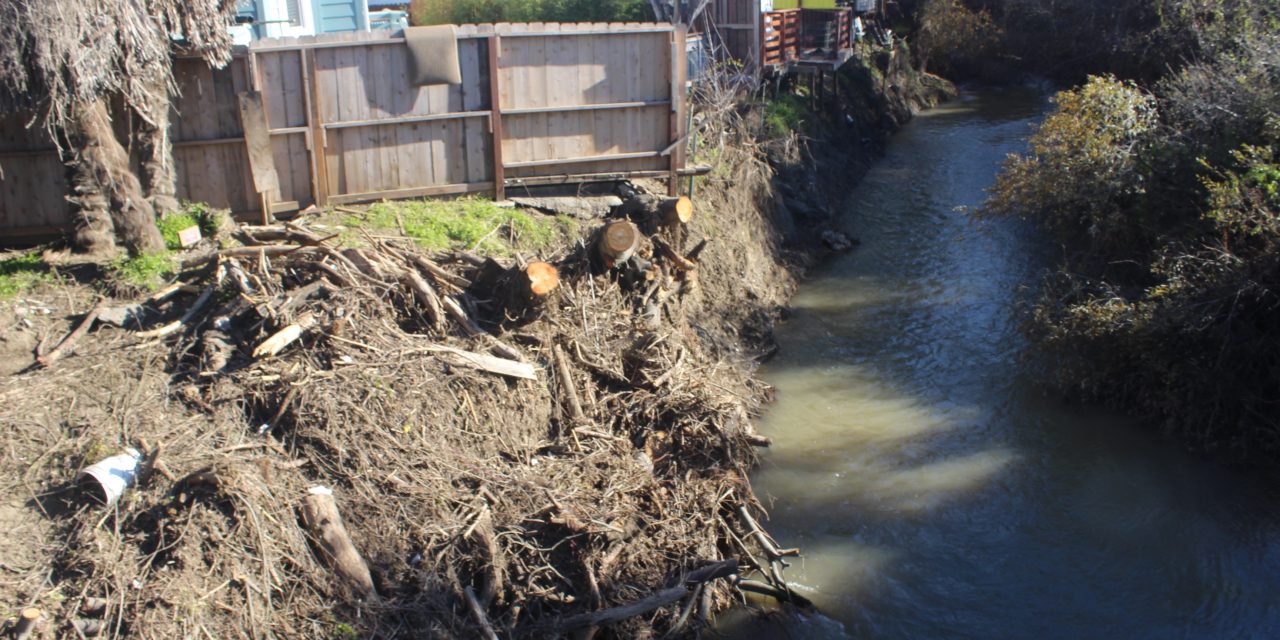
The hardest hit have been mobile home parks (MHP) — Silver City and Silver City West (formerly the Tratel MHP). Businesses along Main Street suffered flood damage, especially with the Jan. 8-9 storm.
Since then, storms have repeatedly either caused flooding or threatened to flood in the same area, causing some no doubt restless nights as the rain falls and the creek rises.
And this year, the creek flooding affected the City Corp Yard and old sewer treatment plant at Atascadero Road and the Embarcadero.
Back in March 1995, a fierce storm dropped 13 inches of rain overnight and flooded essentially the same area along Main Street as was hit this year, roughly a square mile.
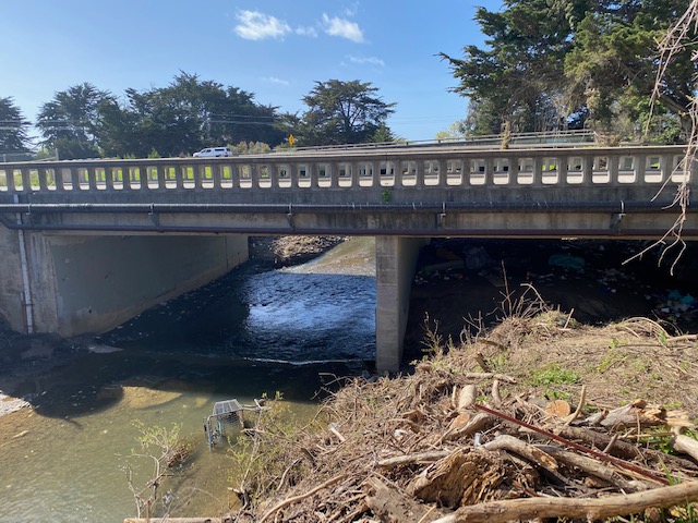
The creek, when it reaches Main Street, goes under a series of road bridges starting at Main Street and including the Highway 1 bridges. In 1995, debris and a tree that had eroded into the creek from upstream got stuck at the Main Street Bridge, causing the water to back up and flood the area.
Morro Bay Life recently met with a resident of the Silver City West MHP who wanted to show us the condition of the Main Street Bridge, which has two “channels” on the left and right. The left main channel of Morro Creek was clear, and water flowed through it. The right side is partially blocked and silted in several feet deep, which appears to have been accumulating for many years. If the bridge’s two channels are supposed to work like a main and overflow channel, the siltation would seem to be hampering that function, at least until the water rises high enough in the main channel to flow over the silt.
Our contact, who decided he did not want to have his name used, was greatly concerned about future storms and the prospects of the park and surrounding area being flooded again.
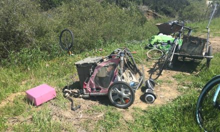
The park’s outer fence was badly damaged in the flooding and is being replaced. Businesses in the flood zone have sustained big losses, and at least one — The Wee Shack — has yet to reopen. The stretch of Main Street still has a lot of mud, now dried to dirt, left to clean up.
But the city said the bridge isn’t the problem. It’s further upstream a short distance, where Morro Creek and Little Morro Creek come together, that appears to be where this latest flooding started.
“The floods have had terrible impacts on the community this year,” City Public Works Director Greg Kwolek told Morro Bay Life. “We are still learning about how the flooding occurred and what future mitigation efforts we should look at as a community, but I can say the flooding is upstream, not under the bridge, and we have evidence of this.”
He added, “The creek did not overtake the bridge on March 10 even though residents and businesses experienced flooding in that immediate area.”
Kwolek said the city is working on the issue of the creek, which as anyone who’s ever tried can attest that it’s very difficult to get a permit to work in or around a creek.
“Generally speaking,” he said, “we’ll be looking at facilitating a community conversation about what is happening in the flood plain there, what our options are as a community, and what direction we want to go in as a city.”
Morro Creek originally flowed through the power plant property and emptied into the bay at Coleman Beach.
The Army Corps of Engineers redirected the creek, draining what was originally its floodplain to turn it into a Naval Training Base during World War II. The base was turned into a power plant in the 1950s when Pacific Gas & Electric acquired it. The creek’s natural flood plain was never restored.
The redirected Morro Creek now empties onto Morro Strand Beach, and the flood plain is now basically the beach. Most of the year, the creek disappears into the sand, and surface water doesn’t make it to the ocean.
Kwolek said they have a good idea of where the problem with Morro Creek lies.
“We don’t believe the bridge caused either flood,” he said of the January and March storms. “The flooding is upstream. We know that now thanks to drone footage taken on March 10 during the flooding.”
This winter’s dozen or so “atmospheric river” storms have reopened another old wound in terms of flooding woes. South Bay Boulevard at the Chorro Creek Bridge had to be closed after the roadway flooded.
It’s been reminiscent of the bad old days when South Bay flooded and choked Morro Bay off from Los Osos at the infamous “Twin Bridges.” That roughly 50-yard stretch of road seemed to flood and close every winter for decades until it was replaced in 1996 with the new Chorro Creek Bridge.
This winter marks the first time it’s flooded since the new bridge was built.
When South Bay closes, it cuts off the only direct route from Morro Bay to Los Osos, cutting off access to thousands of people a day — including school kids attending Los Osos Middle School or Morro Bay High School. When South Bay closes, people have to go all the way to San Luis Obispo to get around the choke point.
South Bay is again a concern for the city.
“We are, of course, very interested in better understanding the Chorro Creek flooding,” Kwolek said. “During the floods, the roadway itself was undermined, especially on Jan. 9, so city staff is very concerned about this area.
“We will be considering next steps, and I would expect to involve a hydrologist at some point in the near future.”
Initial reports after the January storms were that the city estimated the losses and overall damage to public facilities at over $30 million, a number that was surely going to rise with the continued storm activity in March. Damages have ranged from flooding to downed trees. The city could get assistance from the Federal Emergency Management Agency (FEMA), which is possible because SLO County was declared a disaster area by both President Joe Biden and Gov. Gavin Newsom after the storms in January and again in March.